The following article is a paid partnership with Microsol Resources.
Both AutoCAD and Revit rank among the software products with the highest number of plugins on the market. With so many options out there, it can be hard to find the best add-ons for your needs. To help you out, we have selected eight of the best AutoCAD and Revit add-ons for your nature, cities, and topography projects. You can download a lot of them directly from the Autodesk app store or snatch a great deal for a whole package through an authorized Autodesk software reseller.
Best AutoCAD Add-Ons
Spatial Manager
Spatial Manager is a featured AutoCAD plugin that helps you export and import geospatial data between AutoCAD and various platforms in a quick and easy way. Supported platforms include:
- Access
- ESRI ArcInfo®
- Excel
- GML (GML and GZ)
- Google Earth (KML and KMZ)
- GPS
- MapInfo
- OpenStreetMap (OSM and PBF)
- Points
- PostGIS
- Shapefiles (SHP)
- SQLite
- SQL Server
Users of AutoCAD versions from 2008 onward can choose from many background maps from various providers such as Bing, MapBox, OpenStreetMap, and Ordnance Survey. Spatial Manager also allows you to geo-locate streets, neighborhoods, and other geographical objects and zoom in or insert the selected location in your drawings. You also get to create and run terrain models, manage alphanumeric data tables, transform coordinates, and much more.
2D Landscape Design Symbols
2D Landscape Design Symbols was developed in collaboration with industry-leading landscape professionals, making it one of the best landscape add-ons for AutoCAD. This product is professional grade yet affordable and fully compatible with BricsCAD and all AutoCAD products, including:
- AutoCAD
- AutoCAD Architecture
- AutoCAD Civil 3D
- AutoCAD Land Desktop
- AutoCAD Map 3D
2D Landscape Design Symbols packs in a handy block manager, hundreds of landscaping blocks, and various tools to help you increase your productivity, improve accuracy, and conform to ISO and ANSI standards. You can easily and quickly create landscape drawings from scratch using the fully indexed libraries and browsing through categories such as architecture, civil, GIS, hardscape, irrigation, and landscape.
Landscape Design Software Complete Solution
Compatible with the entire AutoCAD family and BricsCAD v.10, this add-on offers a complete architectural and landscape design solution. It integrates seamlessly with your existing menu setups and features both 2D and 3D design libraries. Its functionalities include:
- A surface terrains tool
- A cost estimator and scheduler
- Render-ready 3D model libraries
- 2D and 3D interior architecture libraries
- Fully indexed blocks and easy-to-find categories
- Over 1,200 landscaping symbols, including a plant database
- A block manager to store your blocks and design details
- Bi-directionally hot-link drawings that can be exported to Excel
- Hatch manager and creator with hundreds of professional-grade hatch patterns
- Complex line types for architecture, GIS, and landscape design
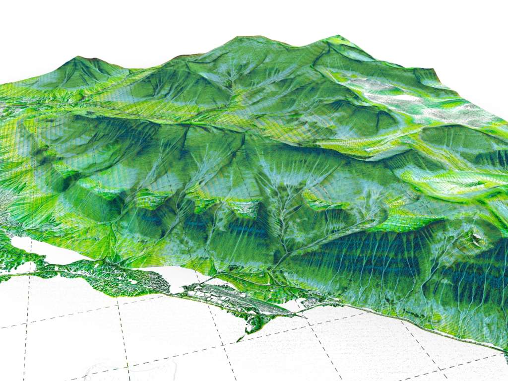
Terrain Modeling for AutoCAD/BricsCAD
This add-on allows you to create 3D terrain models using 2D site survey data with a single mouse click. All you have to do is connect the survey points to form triangles and create a 3D surface model. The models can be produced as solids or polyface meshes, including volumetric data.
With Terrain Modelling, you can easily create 3D terrains covering vast areas, making it ideal for visualization and land studies. Some of its features include:
- Produce surveys from scratch or by applying intelligent markers to existing survey points
- Move markers in your drawing and have their XYZ label automatically updated to reflect the changes
- Convert almost any survey type, including 2D markers, blocks, contour lines, and points in 3D space
- Confine the model to a boundary line or isolate areas of water and buildings using polylines
- Transform surface meshes to volumetric solid models using the built-in conversion tools
Best Revit Add-Ons
Kiwi Codes Bonus Tools
Kiwi Codes offer several add-ons as part of their Revit line, but it is the Bonus Tools that steal the spotlight. They come with various functionalities such as Aligning Views on Sheets, View/Sheet Creator, and Family Tracker that are bound to save you a lot of time.
CADtoEarth™ for Autodesk® Revit®
The latest version of CADtoEarth™ was fully rewritten for an even better user experience and to support the new CadToEarth dashboard. The add-on establishes a bi-directional connection between Revit and Cesium®, allowing you to:
- Create a personal account on the CADtoEarth web app with full control over the visibility of the uploaded data
- Import pre-drawn sketches and surface sections from Cesium into a modeling session using applied satellite imagery
- Obtain information about building layers from Cesium
- Upload 3D structures from a modeling session onto Cesium
- Place 3D structures on imported surfaces within modeling sessions and then reupload them on Cesium
- Convert 3D structures to 3D PDF format
- Collaborate on projects via the Autodesk A360 cloud service and Forge platform
V-Ray for Revit
Thanks to V-Ray for Revit, you can also convert your functional model into a stunning photo-realistic rendering that is great for marketing purposes. To that end, you can use real-world cameras and highly realistic lighting, materials, and environmental effects.
What’s more, you get to explore and change your designs at every stage of their lifecycle — from schematic design and design development to the construction documents and marketing materials.
V-Ray blends in seamlessly with Revit, but you can also use it as a standalone app.
SOFiSTiK Bridge Modeler
With SOFiSTiK Bridge Modeler, you can create 3D bridge models using generic families and alignment parameters and in Revit. The add-on features families for both sub- and super-structure creation. Both can be created from scratch or modified by adding parapets, railings, and other elements as needed. You can also create:
- User-defined tendons
- Bridge component arrays
- Multi-girder bridge components
- Tables with elevation points
- 3D bridge axis using alignment information, imported files, or coordinate points
- 3D solid models of structures created using Structural Lines (SLNs)
SOFiSTiK Bridge Modeler also supports the automatic generation of:
- Elevation points
- Longitudinal sections with vertical alignment information
- Section views with dimensions
- Top views with alignment information
Final Thoughts
AutoCAD and Revit plugins are a great way to mix and match and add to the functionality of your existing software packages. Some add-ons are free of charge, whereas others are paid. The good news is that the vast majority of the paid ones offer free trials.